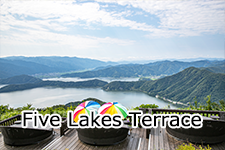
Mysterious Lakes・Mikata Five Lakes
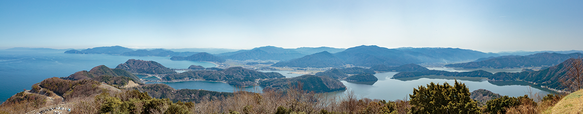
What is Mikata Five Lakes?
Long ago, Mikata Five Lakes were inland lakes far from the coast. At the end of the 4th Ice Age, and in the early Jomon period, the sea level increased by 3-5m and Kugushi Lake became a large cove, and the sediment carried by the Mimi River closed the entrance, and the cove became a lagoon. Other lakes are thought to be fault lakes that formed 500,000 years ago at the settling point of the Mikata fault.
Scenic spots representing the Wakasa Bay Quasi-National Park, they were registered in the Ramsar Convention in November 2005. The five lakes, also known as pentachromatic lakes at different depths and salinities, are home to a variety of fish, from saltwater fish to freshwater fish, and are also valuable habitats for water birds.
In 2011, a 70,000-year manuscript excavated at Lake Suigetsu was certified by the world as a "World Ruler For Dating", and the Fukui Prefectural Manuscript Museum was completed in Wakasa Town in September 2018.
In February 2019, traditional fishing methods corresponding to the characteristics of each of the five lakes, such as the "trawl net fishing" of Mikata Lake, were recognized as Japan's agricultural heritage for the first time in the prefecture.
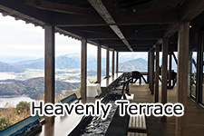
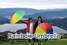
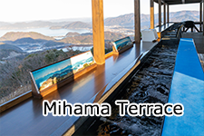
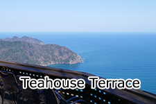
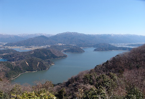
Furthermore, in May 2019, the superb view of the mysterious lakes, Mikata Five Lakes, which can be seen while entering the "Heavenly Footbath" at Rainbow Line Mountain Peak Park, was certified as "Cool Japan Award 2019". | 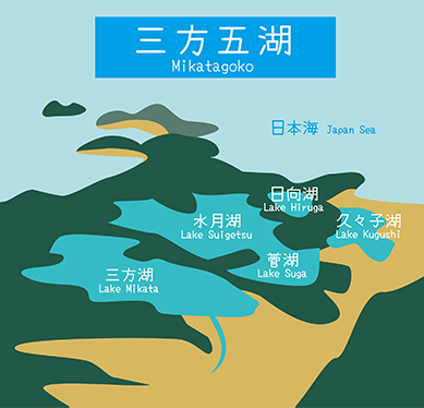 |
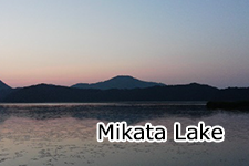
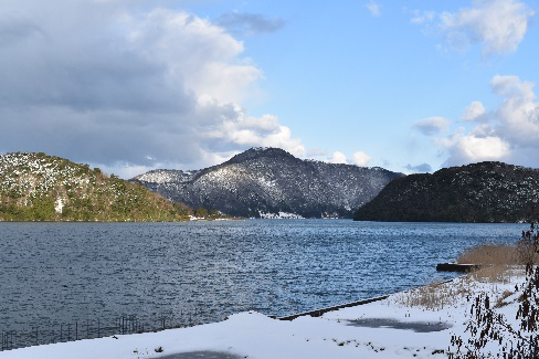
Mikata Lake
 | Surrounding 9.6km Maximum water depth 5.8m Area 3.58km²
It is the only completely freshwater lake among the five lakes. Carp, crucian carp, moroko, shrimp, eel, etc. are caught. From winter to spring, a traditional fishing method called "trawl net fishing" is performed. In addition, aquatic and humid plants such as wet plant reeds and Hishi inhabit. |
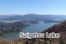
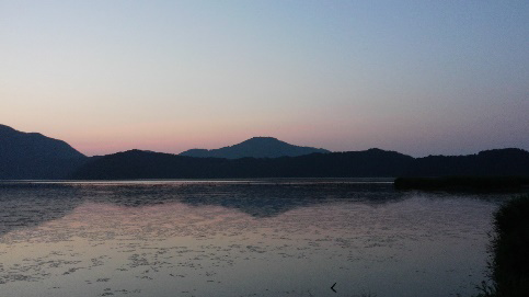
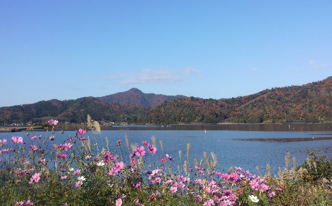
Suigetsu Lake
 | Around 10.80km Maximum water depth 34.0m Area 4.18km²
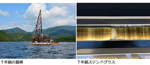
The largest of the five lakes, Mikata Lake is Setoguchi, Kugushi Lake is connected by the Urami River, and it is connected to Hiruga Lake by the Saga Tunnel. It is a brackish lake with half seawater and half freshwater. The "varve" deposited on the bottom of the lake have continued for 70,000 years, and were adopted by the radiocarbon dating method in September 2013, and became the age-specific "World Ruler".
What is the varve?Stripes called "varve" are formed on the bottom of Suigetsu Lake over 70,000 years. Four academic drilling surveys were conducted in 1993, 2006, 2012, and 2014 for this varve study. By analyzing the varve, high-level data on the natural environment and natural disasters at the time were obtained.
In addition, it has also been used to calibrate radiocarbon dating to determine the age of fossils and relics. In September 2013, a calibration curve "IntCa l 13" using data from Suigetsu Lake varve was published. This has greatly improved the dating accuracy of Suigetsu Lake as a "World Ruler" in archeology and geology.
≪Good conditions with the world's best varve≫
(1) Terrain without large rivers flowing in: The lake bottom is not disturbed by the influx of large amounts of water and debris due to heavy rain.
(2) Terrain surrounded by mountains: The wind is blocked, the waves are hard to rise, and the lake water is not disturbed.
(3) Lake bottom without living things: The deep part is a layer without oxygen, living things can not inhabit and it is not disturbed.
(4) Unfilled lake: The lake has been sinking for a long time due to the surrounding faults, and sediment continues to accumulate at the bottom of the lake.
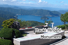
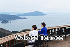
You can check these conditions from Rainbow Line Mountain Peak Park. |
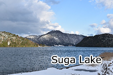
Suga Lake
 | Surrounding 4.2km Maximum water depth 13.0m Area 0.91km²
This lake is the smallest of the five lakes and is the same brackish lake as Suigetsu Lake. Many wild birds such as white-tailed eagles and ducks are observed in the surrounding area. |
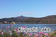
Kugushi Lake
 | Surrounding 7.10km Maximum water depth 2.5m Area 1.40km²
It is a brackish lake where seawater flows backward from the Sea of Japan at high tide because it is long in the north and south and is in contact with the sea. In the past, clam fishing has flourished and aims to revive.
It is also a rowing venue for The Mihama Town's people Regatta (every year), The All Japan Professional Championship, and The National Junior High School Selection Boat Tournament. |
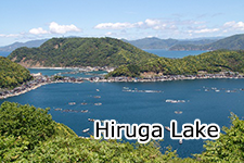
Hiruga Lake
 | Surrounding 4.0km Maximum water depth 38.5m Area 0.92km²
The entrance to a lake is connected to the Sea of Japan, and it is a completely salty lake. The fish are only from the sea, and blackfish and sardines are caught. It is also used as a farm for hamachi, puffer fish, and sea bream, and many fishing visitors come to the two fishing ponds.
The underwater tug of war at Hiruga Bridge, held every third Sunday of January, is an intangible folk cultural property. |
|